Political Map Example-Time Zone Political Boundary
Here's an example of a type of political map. It shows how the states have agreed to deal with the shift of solar time zones across the U.S. according to region and state boundary. This map was designed specifically to be easy to read on a website. The map is simple and clear. The map portrays the time zone theme with easy to understand graphics, insets, and text. It is superior to many other web-maps in its use of symbolization to convey a simple theme. The circular symbols convey four major regional time divisions from the east coast to the west coast. This categorization summarizes continental solar motion by using dials on the four clock symbols.
Political Map Example
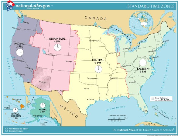
Time Zones Regional Agreement
Lab One Homework One
Static Image
